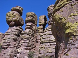
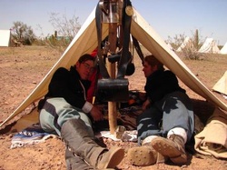
Goodman's Journey
  • Home
  • Blogroll

Saguaro and "OUR CAR'S READY"...

3/31/2008

0 Comments

 
Picture
_31 March ‘08 Monday

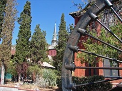
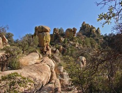
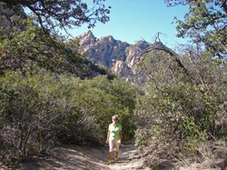
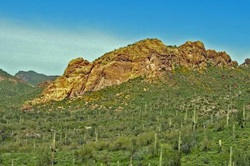
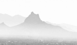
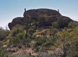
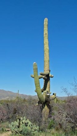
Last Friday we drove up to Tucson to take in another National Park.  Saguaro National Park is split down the middle by the city of Tucson and by the looks of it, it didn’t hurt it a bit.  Our plan for the day was to hike the Cactus Forest in the Rincon Mountains but when we got there we changed our minds.  I’m not sure whether it was because our last hike was in one of the most exciting places or if it was just that we weren’t too excited about the area.  The Saguaro Cactus, the other cactus families, the many different species of birds, and the wild flowers were really beautiful, but taking a 2 to 3 mile hike just didn’t seem to be “the thing to do” today.  Now, a little bit about the Saguaro…it all starts with a very small black seed.  The seed is about the size of the point of a pin and then verrrryyyy slowwwwlllllyyyy grow to 50 feet and weigh as much a ton in 150 years.  That is if they make it…most don’t, but those that do are a piece of art. 


Picture
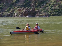
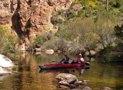
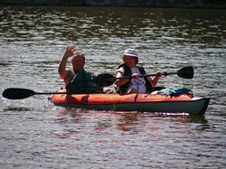
_We also were looking forward to getting our car back from the dealer, but that didn’t happen.  They said that the parts were lost out there someplace…OKKKK    Well that gave us the weekend to go through so we did our best to enjoy it.  You know you can enjoy just staying “home” and “piddling”…and that’s what we did.  We also got together a couple of times with Bob and Marlene Rea to enjoy a dinner and a cool drink or two.  This morning we moved down to Sierra Vista (just 20 miles south of where we were) and in the same city our car has been for the last week.  We did get the call tonight that we’ve been looking for…our car is ready for us. 

0 Comments

The Wonderland Of Rock...

3/26/2008

0 Comments

 
Picture
_26 March ‘08 Wednesday

The plan for the day…Chiricahua National Monument.  Approximately 70 miles east of our campground (at St. George) is the “Wonderland Of Rocks”, otherwise known as the Chiricahua Mountains.  These mountains were the lands controlled by the Chiricahua Apaches and under the leadership of Cochise, who led the Native Americans resistance in the 1860’s.  The ride into this 12,000 acre park took us all the way up to 7800 feet and into some of the most unusual rock formations you could ever imagine.  The territorial views from up there were unbelievable.


Picture
_We would look out to one mountain range and then onto another.  At one time we saw 3 different mountain ranges from this one spot.  Prior to arriving in Arizona last year, my thoughts were that Arizona was mostly flat…well, that was a big mistake.  There are mountains in every direction I look, and some of these are mountains run as high as 12,000 or more feet.  The research on how the rock formations developed here, says that about 27 million years ago there was a huge volcanic action that covered the area with a deep covering of ash.

Picture
_After the ash cooled and fused into a 2,000 foot layer of rock, “the forces of erosion” took place and created the sculpted shapes we see today.   Our 3 mile hike took us in a large circular route that ran down into the canyons below and then back up, and all the while keeping in mind how great a place this must have been to hide a complete nation of peoples.  After finishing our hike, having a bite to eat from our backpack, we drove back down the mountain to visit the Faraway Ranch.  The Faraway Ranch was a homestead that was built by Neil Erickson (who fought against Cochise) in 1888, and was continuously kept in his family until the Chiricahua National Monument was established in 1928. As we walked the ranch and looked into all the existing buildings, it gave us the feeling that the Erickson family could be still living there and, could possibly pull into their “driveway” in just any minute. 

0 Comments

Did Anyone See Coronado's Buddy???

3/24/2008

0 Comments

 
Picture
_24 March ‘08 Monday

Sunday we stayed close to “home” and didn’t do too much, but on Monday we headed south to Bisbee.  Bisbee is about 40 miles south of St. George, were we are now, and 2 miles north of the Mexican border town of Naco.  Now Naco doesn’t have too much to brag about but being a small Mexican town that supports the copper mines of Bisbee with man-power.  The drive to Bisbee was quite beautiful as we drove through the high desert.  Fact is, Bisbee is over a mile high and sits in a beautiful cut between two mountains.


Picture
_The streets of Bisbee are narrow, winding, and all going uphill (OK, some go downhill too).   All this, is best enjoyed by walking.  The whole town is listed on the National Historic Register and you can certainly see why.  The main commercial area is old and “historic”, and the small homes that cling to the hillsides of the mountains are quaint and beautiful (some more than others).  We took a great walk through Bisbee and found lots of interesting places, things,

Picture
_and people that make Bisbee “Bisbee”.  Just as you leave town to the south you find the huge copper mine terracing it’s self far below the highway.

Picture
_At one time Bisbee was the largest city between St. Louis and San Francisco as well as being one of the richest mineral deposits in the WORLD.  Today it’s a reminder of the “Good Ole Times and the Past Charms” of days past.  Lunch time came just in time…  as we were passing the front porch of The Copper Queen Hotel, we knew we had found just the right place…  Now it was on to find were Coronado passed through between 1540 and 1542.  While we were there we just happened to run into one of his “soldiers”.

Picture
_What were Coronado and his crew doing in this area???...one word, GOLD !!!  It was never found.  Heading a little further West, we found ourselves in Sierra Vista again.  The last time we were here we were heading to Parker Canyon Lake but this time, I wanted to find the Suzuki dealer that I heard was here.  We’ve been having a “whine” coming out of the transmission and I wanted someone to look into it.  After finding the dealer, going for a test drive with the mechanic, and calling the Suzuki rep, we found ourselves driving a loaner car back to the coach.  They feel that there are at least 2 bearings that need to be replaced so why not get it done right now??? 

0 Comments

Cinnamon Rolls and Cochise...

3/22/2008

0 Comments

 
Picture
_22 March ‘08 Saturday

In this campground, Saturday morning is “Cinnamon Roll” morning…  Yes, I know, I know, but I feel I must have one and you know how “good” they are for me…  After a quick trip to Wally World (Wal-Mart), we decided not to waste the rest of the day at home so we headed east on Hwy 10.  Our destination was the Cochise Stronghold.  The Chiricahua  (cheer-E-cow-a) Apaches, led by their chief Cochise, used a natural granite fortress as their “haven” from the U.S. Cavalry.  This is also the place that is believed to be the final resting place of Cochise.  Cochise wasn’t killed but actually died of old age.  His son, who became Chief of the Chiricahua Apaches, is believed to have buried “The Chief” somewhere in the rugged natural fortress of the “Stronghold”.  At one time, Cochise led more than 1,000 followers, of which some 250 were warriors.  As Louise and I hiked the trails of the Stronghold,


Picture
_we could feel the presence of the Apache warriors above us, ready to sweep down to do what they did best…they really had a perfect fortress to set their defenses and it worked perfectly.

0 Comments

Doc Holliday And Crew plus Geronimo...

3/21/2008

0 Comments

 
Picture
_21 March ‘08 Friday

About 25 miles south of our campground here in St. George is the town of Tombstone, a spot in Wild West infamy and we were going to check it out today.  Main street Tombstone has been kept as close to original as possible, including having a light dirt spray put over the asphalt.  The only wheeled vehicles that are allowed on main street are 3 or 4 stage coach and mounted and un-mounted horses.


Picture
_ You could almost feel some of those who graced the OK Corral, Big Nose Kate’s Saloon, and other places like the Bird Cage Theater were Doc Holliday played some of his best poker.  The OK Corral still has the re-enactment  of the famous “gunfight”, but today it costs $7 per person to watch it…  I wonder if they charged admittance in 1881?

Picture
Picture
_After walking the town, sharing a steak hoagie sandwich, we headed off to Sierra Vista and then Fort Huachuca.  Sierra Vista looks like new and is growing leaps and bounds.  It also sits right next door to Fort Huachuca which is not only a historical site that is said to have been the location that was instrumental to the surrender of Geronimo in August 1886 but is still a very active military base for the Army.  We were able to drive through the base, as we wanted to go to Parker Canyon Lake, and taking that route saved us about 50 miles or travel time of an hour or more.

Picture
_Driving through the base and then through Parker Canyon proved to be stunning.  The roads were very narrow and winding

Picture
_and the mountains, hills, and vegetation outstanding…it was well worth taking the ride today.  The unfortunate thing about Parker Canyon Lake, it’s too far away to give us a day of good kayaking.

0 Comments

Another Honey Do Project...

3/20/2008

0 Comments

 
Picture
_20 March ‘08 Thursday

Yesterday morning it finally happened…our shower faucet let go.  This wasn’t really a surprise to us as it had been “acting” a little funny the last couple of months and when Louise turned the water off the cold side started spitting water all over the shower.  Fortunately I had already contacted the technical people at Monaco a couple of months ago and they had given me a possible idea as to what I had to do to replace the faucet.  What they had told me was so impossible to believe I called for another opinion…they gave me the same answer.  The shower stall sits on the corner of the wall that backs to the kitchen and the faucet is directly in the corner of the shower stall.


Picture
_Now, attached to the kitchen wall are floor to ceiling and doorway to exterior wall, beveled mirrors and they have to be removed.  Yep, they have to be taken off so that I can get to the back of the shower to remove 2 retaining nuts and remove and re-install the two water lines, and that’s all...  As it was, neither Louise nor I had really liked the mirrors but there wasn’t really any reason to take them down until now.  So for having the faucet go out gave us the reason and timing to get rid of them.  There is only one more thing we have to do now and that is pick out a new wall covering and get it mounted over the hole we now have in the kitchen.  I was a little surprised as to how little time it took to get the wall of mirrors off, the faucet replaced, and settling down to lunch having gone as far as I could in finishing the project…now let’s get ready for a sharing a bottle of wine with Dave and Carol (a couple that purchased one of my kayaks).  Louise and I look forward to doing some paddling with them back up in Washington. 

0 Comments

Joelle's Here...

3/12/2008

0 Comments

 
Picture
_12 March ‘08 

Joelle arrived right on time yesterday and we all stayed close to the coach to do a little catching up on “family happenings”…but today is going to be something else.  Louise and I had such a great time up at Tortilla Flats kayaking the other day, that we thought Joelle would enjoy it just as much.  All of us were out of bed early, enjoyed breakfast, and headed out for a long day.  Our first stop was at Goldfield, an old mining town.

Picture
_Goldfield looks across a grass valley that climbs steeply up Superstition Mountain. 


Picture
_Superstition Mountain is where the many legends come regarding the “Lost Dutchman Gold Mine”.  If this is where the mine was, it was never re-discovered, although many a man and woman had tried.  An hour later we were winding our way through the spring flowers that have sprung forth covering the southern sides of just about every mountain and hill in southern Arizona. 

Picture
_A little later in the spring we will see the cactus bloom but for right now we’re looking for lunch.  The last time we were at Tortilla Flats, we saw this great looking, but funky restaurant, so that was our goal for lunch.  Twenty minutes later, after traveling this most beautiful winding and twisting road, we pull up in front of our destination…unfortunately, so did half of Arizona.  The waiting line was no less than 2 hours before enough room would be made for us.  Well that just wasn’t going to work.  The ladies were really getting hungry so I went looking for an alternative, another restaurant…  The “other” restaurant was 10 miles further down the road, but the “road” was DIRT !!!  With two hungry ladies riding in the car, it meant only one thing…go for the dirt.  This not only changed our lunch plans it changed our kayaking plans as well.  On the other side, it meant that we had another choice of restaurants and hopefully we would have another location to explore by kayak.  Fortunately all went well…we found that “other” restaurant (which was good, but I’d rather have had lunch at the first one), had lunch, and then continued for another 10 “dirt” miles to Lake Roosevelt.  Just before the dam, we found a small campsite that gave us access to the river.  Within 15 minutes, Joelle joined me in the kayak and we headed up-stream.

Picture
_Just like it was further downstream at Tortilla Flats, the scenery and the water were perfect for kayaking…

0 Comments

Good Friends And A Good Paddle

3/10/2008

0 Comments

 
Picture
10 March ‘08 Monday

Louise and I have been looking for a place to hit the water with our kayak for over a month.  Last Saturday, when we were having our “garage sale” and showing our kayak, Jim and Carlotta Lindeman came by. 


Picture
_Now Jim was giving some thought to purchasing another kayak so that when his twin brother comes down from Alaska, he would have a kayak for him and his wife to use.  Jim and Carlotta have their own kayaks and asked if Louise and I would like to join them for a day trip to Tortilla Flats.  They came by in the early morning, I tossed our kayak and accessories into their trunk, and we were off.  Tortilla Flats is about 30 miles east of Phoenix or 70 miles northeast of Casa Grande.  The weather couldn’t have been better.  Tortilla Flats is a large water area with fingers that run off in all directions.  With deep walls of solid rock, it was difficult to find a place for lunch.

Picture
_The flowers were covering the hills all around us and some of the rocks were actually a complimentary cream color…it was amazing.  We were but just a few boaters on the water today.  As we paddled from one “finger” to another we were most often by ourselves but with a couple of exceptions.  One exception was two ski boats tied together and all aboard seemed to be having one heck of a good party.  The other was a paddle-wheeled excursion boat, and that was filled with visitors to Tortilla Flats.  Louise and I were excited to get back into our kayak again and it was a lot of fun paddling alongside of Jim and Carlotta for the day.

Picture
_Well, tomorrow morning we run to the airport and pickup Joelle (our youngest daughter) who will be spending a few days with us.

0 Comments

Re-enactment At Picacho...

3/9/2008

0 Comments

 
Picture
_
9 March ‘08

Sunday

Well I thought we were going to Mt. Picacho yesterday, but with the garage sale, we had to pass and make it today.  Fortunately for us, the re-enactment was still going on.  The particular skirmish that we were going to observe was the Confederate victory at Glorieta (the Gettysburg of the West), New Mexico. 


Picture
_The story goes that after the Confederate victory at Valverde, the Texans had arrived at the mouth of Apache Canyon, just east of Santa Fe.  They were looking to choke the access of the Santa Fe Trail to the Union.  The Confederates had about a thousand men and 3 cannons while the Union

Picture
_numbered about 850 men and 8 cannons.  Well when the fight hit the fan, the Confederates had driven the Union way back and it looked like their back was broken.

Picture
_It very well could have been but a small group of Union soldiers had slipped by the Confederates.  What they found when they got around them was all of the stash the Confederates had left in hiding.  Things like huge supplies of ammunition, all of their food (with the exception of that the soldiers were carrying into battle), their wagons and the remainder of their horses.

Picture
_With a couple of well placed charges  the whole stash was up in smoke.  This spelled disaster to the Confeds who won the skirmish but lost the war…  Well anyway, we arrived with our beach chairs in hand, water, a little snack, camera and lots of suntan lotion and found a location to set-up our “camp”.  The re-enactment was held in the sage and cactus at the base of Mt. Picacho so that gave us the opportunity to find a place on the hill side and among the rock and brush to set our chairs.  We also visited the encampments and visited with both the Confederates and the Union soldiers, and also found ourselves in line to get a glass of “root”beer and a bag of KETTLECORN???  We spoil ourselves sometimes… 

0 Comments

"Hohokam",Those Who Are Gone...Who's Gone???

3/8/2008

0 Comments

 
Picture
_8 March ‘08 Saturday

Today started out with a neighborhood garage sale and I took advantage of this to market our kayaks.  I must admit, we had great interest.  I sure wish we would have had some water around us, it would have been great to do a little on water demo…  As I see it, the closest water is 25 miles east of Tempe so this makes it a little difficult to get all interested parties there.  Oh well, if they really like it like we have, they’ll contact me when they can.  The rest of the afternoon we were touring the ruins of “Hohokam” Casa Grande.  This is one of the largest “prehistoric” structures ever built in North America and its just 25 miles away.  

Picture
_The area was established by the Hohokam and used primarily as irrigation farming with a little trade tossed in.  All this took place about 1350 C.E., and then without a trace, the ancient ones flat out disappeared a thousand years later.  Actually “Hohokam” means “Those Who Are Gone”, which is pretty fitting if you ask me.  There’s not much left of this great area but a few walls, that are thought to have been used as security walls, and the “Casa Grande” or great house.  Back in the mid 1800’s, the early arriving tourists started taking too many souvenirs home, so fortunately President Benjamin Harrison stepped in and saved all that we are able to see and enjoy today.  By setting aside one square mile of Arizona Territory surrounding the Ruins of Casa Grande, he established a national treasure and the first prehistoric and cultural reserve. 

0 Comments
<<Previous

    *Locations*

    All
    Amsterdam
    Austria
    Belgium
    Bosnya
    Canada
    Croatia
    Czech Republic
    Egypt
    England
    Estonia
    France
    Germany
    Germany Part 2
    Greece
    Hungary
    Ireland
    Italy
    Latvia
    Lithuania
    Luxembourg
    Madrid
    Mexico
    Mexico Bcs
    MX - Cabo San Lucas
    Netherlands
    Poland
    Portugal
    Scotland
    Serbia
    Slovakia
    Slovenia
    Spain
    Switzerland
    Turkey
    USA - Alabama
    USA - Alaska
    USA - Arizona
    USA - California
    USA - Colorado
    USA - Florida
    USA - Georgia
    USA - Idaho
    USA - Illinois
    USA - Indiana
    USA - Kentucky
    USA - Louisiana
    USA - Maine
    USA - Maryland
    USA - Massachusetts
    USA - Michigan
    USA - Minnesota
    USA - Mississippi
    USA - Montana
    USA - Nevada
    USA - New Jersey
    USA - New Mexico
    USA - New York
    USA - North Dakota
    USA - Ohio
    USA - Oregon
    USA - Pennsylvania
    USA - Seattle
    USA - South Dakota
    USA - Tennessee
    USA - Texas
    USA - Utah
    USA - Vermont
    USA - Washington
    USA - Wisconsin
    USA - Wyoming
    Utrecht Nl
    Wales


    *Archives*

    November 2016
    September 2016
    August 2016
    January 2016
    December 2015
    November 2015
    October 2015
    September 2015
    August 2015
    July 2015
    June 2015
    May 2015
    March 2015
    February 2015
    January 2015
    December 2014
    July 2012
    January 2012
    December 2011
    November 2011
    October 2011
    September 2011
    August 2011
    July 2011
    June 2011
    May 2011
    April 2011
    March 2011
    February 2011
    January 2011
    December 2010
    November 2010
    October 2010
    September 2010
    August 2010
    July 2010
    June 2010
    May 2010
    April 2010
    March 2010
    February 2010
    January 2010
    December 2009
    November 2009
    October 2009
    September 2009
    August 2009
    June 2009
    May 2009
    April 2009
    March 2009
    February 2009
    January 2009
    December 2008
    November 2008
    October 2008
    September 2008
    August 2008
    July 2008
    June 2008
    May 2008
    April 2008
    March 2008
    February 2008
    January 2008
    December 2007
    November 2007
    October 2007
    September 2007
    August 2007
    July 2007
    June 2007
    May 2007
    April 2007
    March 2007
    February 2007
    January 2007
    December 2006
    November 2006
    October 2006
    September 2006
    August 2006
    July 2006
    June 2006
    May 2006
    April 2006
    March 2006
    February 2006
    January 2006
    December 2005
    November 2005
    October 2005
    September 2005
    August 2005
    July 2005
    June 2005
    May 2005
    April 2005
    March 2005
    February 2005
    January 2005
    December 2004
    November 2004
    October 2004
    September 2004
    August 2004
    July 2004
    June 2004
    May 2004
    April 2004
    March 2004
    February 2004
    January 2004
    December 2003

Goodman's Journey © 2021 | All Rights Reserved.
​Website Creation by Amy Riordan, LLC