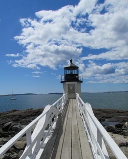
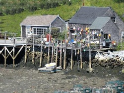
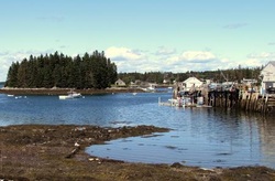
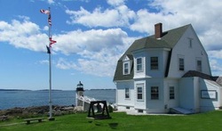
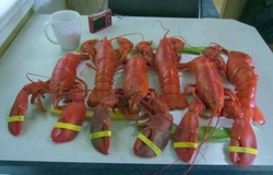
 _One thing we really like about the Maine coast is just how rugged and truly warm it is. By that I mean the buildings are beautifully designed and always giving out a warm “welcome” feel even as you walk in or drive by. Then as you drive down to the wharf to search out a great restaurant or find the boat bringing in their catch of lobster, you find the “rugged” fisherman’s digs.  _Today was going to be our last here in this area and we still hadn’t been clear down to the end of this long peninsula to visit Port Clyde.  _As most of the other peninsulas and bays we’ve visited, the kayakers are out enjoying the beautiful waters and checking out the water views of the many lighthouses along the long coastline.  _Well once again we go back “home” with so many memories AND something we can fill our hunger with…  _we’ll enjoy 3 tonight and save the other 3 for another night in the near future.
0 Comments
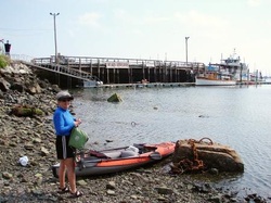 _We’re back…(at the Elks in Rockland that is ). 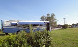 _All settled in and off we go…. It’s been a while since we took the kayak out so we decided today was it, we’re going out into the bay and do some exploring by water. Rockland Harbor is protected from the ocean by a granite jetty that extends out from the shore just under a mile. The base of this mammoth jetty is 145’ across and the top is 40’ of huge granite blocks put together like a jig-saw puzzle. 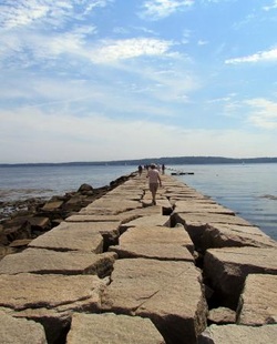 _Walking a quick pace took us a little better than 25 minutes to walk out to the end and another 25+ minutes to walk back. So having walked out there we decided we should paddle out as well. Besides, it was a great day for a paddle. Sun was shining, the temperature was in the high 70’s, and we just want to enjoy the water up close and personal. By the way, the ocean temperature up here in Maine is 60+ degrees, Washington are you listening? It was amazing to be right out there with the lobster boats 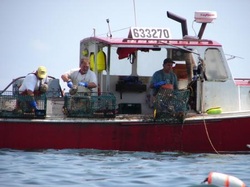 _as they were collecting their catch and making sure that once they were ready to head for the next pot we were out of their way. They don’t waste any time in between one pot and the next. We also enjoyed being out there with the large sailing vessels. In full sail they float by without a sound while all those aboard give a wave as they pass, it’s something about the water I guess. 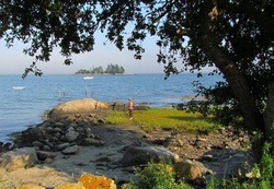 _For a couple of reasons we left the Elks at Rockland (but we’ll go back soon) and moved to a campground at Waterman (just 10 miles down the coast). The reasons for the move, we would be right next door to a beach restaurant that won a James Beard Culinary Award AND with the campground being right on the shores of the Atlantic, 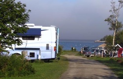 _it has ALL the hook-ups…can you believe we need to empty the tanks again? One thing we liked about Miller’s Lobster House is its VERY informal atmosphere, using plastic table clothes on old picnic tables and plastic forks….how good is that ??? Well it was good enough that we decided that Miller’s Lobster House was the place where we would celebrate our 51st wedding anniversary. 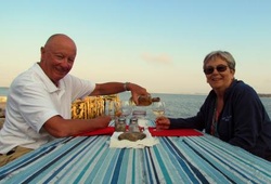 _We’ve enjoyed a lot of lobster already so we decided to order 4 pounds of steamed clams followed by some yummy homemade pie. Millers offers soft drinks but advertises for all to BYOB if you want something else, so we brought a bottle of white wine to compliment our clams. 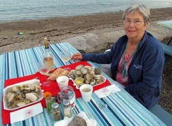 _We also had a great opportunity to explore further down the coast from here and guess what we found? Boats everywhere…all unloading their catch of lobster at one of the many co-ops. 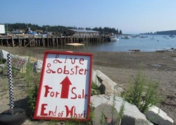 _Well here we go again. With one of our insulated bags in hand, we walk down the gang-plank with cash in hand and negotiate the price of 6 1 1/4lb really fresh lobsters. Ok, $24…we’ll take them off your hands 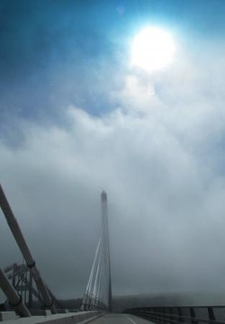 _ Louise is amazing…thank God I’ve got her to be my tourist guide. For the last EIGHT YEARS she’s been doing an outstanding job and all I have to do is FOLLOW HER INSTRUCTIONS !!!! Well today is no different. She wanted to stop at The Penobscot (love that name…) Narrows and see the amazing bridge by the same name. The Penobscot Narrows Bridge and observatory is supposed to be the “Crown Jewel” of coastal Maine with its spectacular views, stunning design and unique and historic Fort Knox. 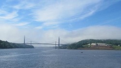 _We enjoyed the ride up to the observation deck this morning. It didn’t take but a few seconds and we were at the 420 foot level or 42 stories above the river. 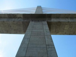 _This turns out to be the “tallest OCCUPIED” structure in Maine. “As soon as the elevator stopped and opened the doors at the 42nd story, you had a full length window directly in front of you. It was a great stop for the morning and one that we highly recommend to all that head this way. Prior to getting to the bridge we stopped to explore the boardwalk 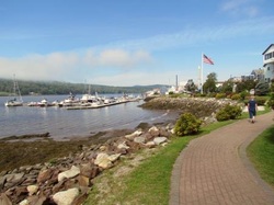 _and village of Bucksport ( now I’m not saying this is a strange name but…). Bucksport is a really small community with a HUGE view to enchant you every time you come into town. 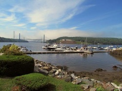 _That view reminds you of the history of Fort Knox and Waldo-Hancock Bridge. Now talking about history, let’s explore a short version of the history of Fort Knox. First off, it never found it’s self-involved in a war or skirmish but was commissioned in 1825, just 13 years after the British seized control of the river. 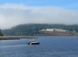 _Two years later the US government then recognized the importance of the Penobscot River and built this fort to secure and maintain the severance of this river and Bangor’s ship building industry. Fortunately there never was another run up the river by the British and the only shots that the fort made from their huge cannons 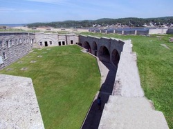 _were shot in practice only. It’s design was “perfect” for such a place on the river so maybe that’s the reason the Brits decided to stay away. Now, it’s the perfect backdrop for the tallest observatory in the world and one of the most beautiful bridges we’ve ever had a chance to see and drive across. Fortunately we arrived when the fog was totally engulfing the river and the bridges. 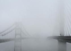 _I say “fortunately” because of the picture possibilities before me…I just hope that I did a decent job of capturing it. Sitting beside the “new” Penobscot Narrows Bridge we found a ghost… The Waldo-Hancock Bridge 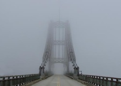 _was built in 1931 and one day found that it wasn’t doing what the populous needed. The total height of the Waldo was 135 feet and cost $850,000 at that time. Now the question is; what are they going to do with it??? When you see the two bridges side by side, either in the fog or in the sun, they present a great picture of now and then... 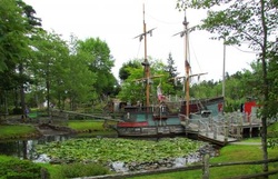 _ Driving into Maine gave us a “Finally” moment… This journey took us across the top of the “Good-Ole” USA and over 4,400 miles when we drove into our furthest eastern stop, Arcadia National Park. I’ve got to admit, it’s been a great adventure and a wonderful opportunity to see and visit family and friends along the way. We’d been carrying close to full tanks (black and gray) gaining in volume from Longport, NY to finally finding a “dump” location just outside of Bangor, Maine. When we pulled into Maine and stopped by one of the entry Information Centers we found that a large truck stop a mile up the road had all the facilities we needed and “if” we re-fueled the facilities would even be FREE. We had stopped by a campground once on the way and they wanted to charge us $20. Hell, the last place that we used only charged us $5 when we weren’t parked there for the night. Feeling much lighter and without that “worry” heavy on our back’s we continued east to Ellsworth and another Elks. When we pulled into the driveway of the Elks we found 12 more RV’s enjoying the hospitality offered by this club. I guess all the excitement bringing in the many travelers to this area is three fold; Acadia National Park (second most visited National Park), the state of Maine and all its natural beauty, and of course the LOBSTER… Yes LOBSTER… We (I) have been looking forward to the Maine LOBSTER for a long time and now that we’re (I’m) here we’re going to ENJOY the heck out of each and every (most of) meals we’ll have here (and we’re planning to be here for A LONG TIME !!!). We’re also here to see and enjoy the people of Maine and the wonderful sights of all this pure nature area. The day after setting up at the Elks, we headed the 5 miles further east into the Acadia NP for a full day of exploration. There is a 27 mile loop road through the park that we decided to take for our first outing. The park is located on a large island that is attached by a short bridge to the mainland. The island, Mt. Desert Island, is shaped like a large Lobster claw with several lakes and hundreds of inlets along the shoreline. One thing we’ve learned about the Maine shoreline, there will be hundreds of inlets, some short and some very long, and hundreds of islands to explore or view from afar. On our first drive around the park we stopped to explore the huge granite rock formations making up most of the shoreline. 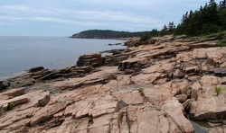 _You can only imagine them when the Atlantic Ocean heavily crashes during those winter storms as they push onto the coast. High up (1,500 feet) we reach the summit or the highest point on the eastern sea coast, Cadillac Mountain. We really enjoyed our look out over the Atlantic and the many islands below. 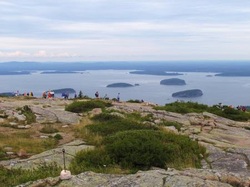 _Other ways of exploring Acadia NP besides riding in your own car, is by horse drawn carriage or the “free bus” that you can hop off and on at will. One of the few buildings in the park is this old carriage house. 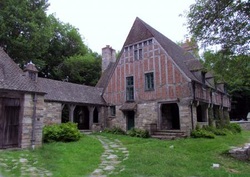 _As beautiful as it is, it’s not being used anymore. By the time we finished our first drive around the park we were ready for something to eat, and to find that place we had to drive out to Bar Harbor. 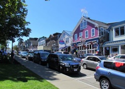 _Bar Harbor is located just outside of the park entrance so getting there was easy enough but finding a parking place for the car was much harder. Fortunately we arrived at a location to park just as someone was leaving. The time and place just weren’t right for our first “Lobster” so we opted for a bowl of “chawda” and lobster bisque…it’s got to be good if it’s called “chawda” doesn’t it??? 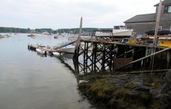 _Oh by the way, they have two of the most amazing “Goofy Golf” courses I’ve ever seen here on the island. That’s one of the holes pictured at the top… 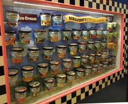 _Well yesterday we crossed over into another “New” state for us…Vermont. We stuck close to the Canadian border until we crossed the bridge over Lake Champlain. From there we took Route 2 heading south. This route took us right through the middle of Lake Champlain while “jumping” from one island to another until we finally reached Burlington, Vermont. The University of Vermont, and at least 3 additional colleges, are located in Burlington and we found the city well covered with young people heading into higher education while still enjoying the city and this beautiful lake. The Elks have stepped forward again and has offered us a wonderful place to park the coach. It was about 3 miles outside of town but close to other stores we might want to take advantage of when or if the need was to arrive. We met a couple at the Elks that have made this their second year to spend a couple of months to explore Burlington and the surrounding area. Burlington AND Lake Champlain are a great combination and would be a place I would highly consider spending a lot of time at some time in the future. But after spending a couple of days in Burlington we head off to get a free sample of ice cream… In a little town (Waterbury) just 20 miles east of Burlington sits a company that has reached across much of the world to deliver a pint (or more) of ice cream. 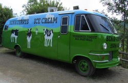 _At least one of Ben and Jerry’s many quirky named ice cream filled containers have found their way into our refrigerators. Well we wanted to see just where this ice cream got its start and get our “Free Sample” at the same time. The Ben and Jerry story is well known but it was also good to learn just a little more as to how much they support the local vendors and do as much as they can to make their ice cream as “Green and Clean” as possible. Speaking about Green and Clean, how about Red and Old…. Another 15 miles down the road we entered Montpelier, the capital of Vermont and quite a few covered bridges. 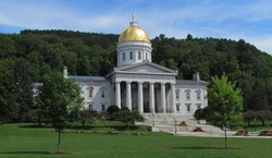 _Montpelier was having an art and food festival when we arrived and seeing as how it was lunch time….unfortunately we chose the wrong vendor. Not only did we chose the wrong food vendor we were entertained by a huge group of motorcycles and riders making their “noisy” way through town and then back again a couple more times. 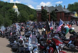 _The only negative thing about the bikes was that I wasn’t a part of them… Finally finished with lunch we unhook the car at the visitor’s center and drive off to find some of the wood bridges we’ve heard about in Vermont. 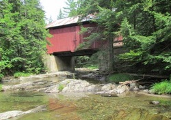 _Over a distance of 15 miles we came across 4 bridges that looked much the same in design and age (They were all built in the mid 1800’s).  _1000 International Islands on the St. Lawrence Seaway… That’s what the literature says but our tour guide told us that there are closer to 1800, but now I’m getting ahead of myself. Yesterday we drove up the “Seaway Trail” from Niagara Falls to our campground just short distance west of Clayton, a small village alongside the St. Lawrence River. 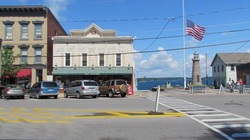 _We were lucky in finding a campground. As long as we only stayed 2 nights we were ok as the weekend was filled. Our weather has really changed. Our drive yesterday was accomplished while driving in and out of a heavy rain storm which had set in the night before and today it’s off and on with a little sun to make an appearance. This morning we drove up to an area called Cape Vincent. It is filled with great homes lining the St. Lawrence River, but we were there to see and explore the Cape Vincent Lighthouse. 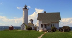 _The lighthouse is much like those we see along the lakes, but most of them aren’t nearly as well kept as this one. There was one thing that the Cape Vincent Lighthouse had that no other lighthouse on the Great Lakes has, a working Hostel Hotel. The lighthouse and the gift store are run by a local couple. In their agreement to run both of them, all the profits go to the efforts of keeping the lighthouse in good shape. The hostel has a separate agreement but the lady from the gift store didn’t want to talk about it…sounds like there might be a problem between them. On the way back through the little village of Cape Vincent we stopped at Crazy Jacks for lunch. It sits next door to the ferry terminal so we had some extra “entertainment” to enjoy during lunch with. 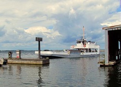 _The ferry travels a short distance of less than two miles with a full load of cars not exceeding 8 across the river to the terminal in Canada. They can’t take anything larger than a small commercial van but all they had today were 5 cars and 3 bicycles. We finished lunch and headed back up the road past Clayton to Alexandria Bay to catch a tour boat that would take us out into the St. Lawrence River for a couple of hours. 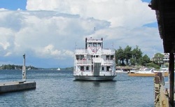 _It was a tour that would take us around 50 to 60 of the islands and feature some of the most amazing private homes you’ve ever seen. One of those homes (a castle that was designed after a full sized Rhineland-style that is…) 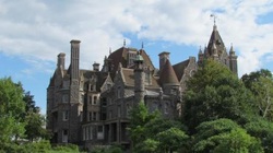 _was the gift from millionaire George C. Boldt, who was the proprietor of the Waldorf-Astoria hotel in New York City to his beloved wife Louise. 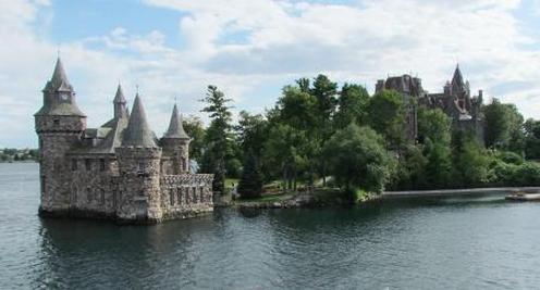 _This dream was well into the fourth year of construction when George got a cable from New York that Louise had died unexpectedly. For George this was just too much and he stopped construction immediately. He never returned to the castle, which remained vacant for over 73 years. Construction on this 6 story 120 room castle began in 1900. The grounds consisted of Italian gardens, a children’s playhouse, 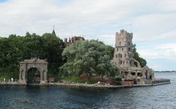 _powerhouse, and across the channel an amazing Yacht House. 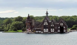 _Today the castle is owned and operated by the Thousand Islands Bridge Authority and since 1977 has been investing millions of dollars for restoration. There were a lot of homes that didn’t meet the Rhineland Castle description on the river, from modern villas to small 2 room homes that all sat on their own island. 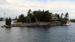 _By the way, requirements to be an island here at the 1000+ islands, is that it must have a tree and had never been covered with water, that’s it. We saw one “island” that was about 12’ in diameter but it didn’t have a house on it just a tree... Unfortunately we saw some of the results of the economy even here 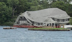 _…a little damage from a storm that will not be repaired because the ex-owners have walked !!! 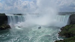 _After a full day and a half exploring Lockport and receiving a TON of suggestions from friends and people we’ve come across here in the area, we decided it was time to drive across the border. That meant we had to back track to Niagara Falls and cross the Rainbow Bridge into Canada. What we had heard was absolutely true, and we knew it would be. We had no sooner crossed the bridge (which took about 10-12 minutes in line and going through customs) and what we saw was how the Canadians had made a park like setting for miles along the Niagara River. 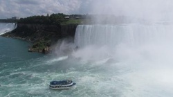 _There were extra wide sidewalks complimented with beautiful landscaping covering the full length of the Niagara Falls view corridor. 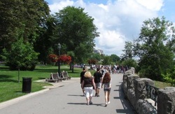 _Parking for all the cars was handled by huge parking lots a mile or two further down the road and for $10 we had a parking spot and a great round trip tram ride directly to the best view locations they have to offer. Fortunately the only thing we had to worry about was whether or not we had enough drinking water with us… Weather was great, crowds light and courteous, and we got an early enough start so that we could see all we wanted with ease. I was hoping that the wind was going to blow the spray down and away from the falls but unfortunately it stayed just as it did a couple of days ago, right in the way for one of those grand pictures. 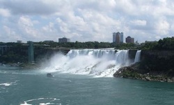 _Taking the tram back to our car we continued up the Canadian side of the Niagara River. About half way to Lake Ontario we stopped by to look over the “Whirlpools” of Niagara. 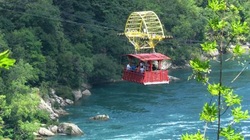 _It’s at a bend in the river and offers to those with a spirit of excitement the opportunity to ride one of those very high powered flat bottomed boats that will take you flying over the rapids and pools. It looked like something we would love to do but timing is everything and we didn’t have enough left for the day. Instead we continued our way to a little town located were the Niagara River empty’s out into Lake Ontario. It’s called Niagara On The Lake and is one of the most picturesque towns we’ve seen in a long time. 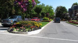 _This small community was soooo busy that we couldn’t even find a place to park our car. Cars filled all the parking lots and every inch of legal parking along the streets. 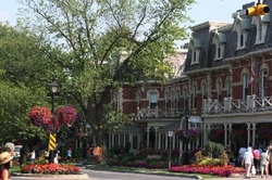 _Oh well, the ride through town a couple of times made the drive up the coast worthwhile. We knew the day would have to come to a close and we knew we would then have to go back over the bridge to the good ole U.S.A… The problem was TIME, the time it takes to go through the LLLOOOOONNNNNGGGG line at the border. Going back to the U.S. does take a lot more time than entering Canada but there was no other way. 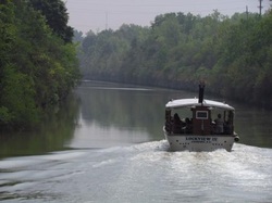 _8 Aug. 2011 Today we left Niagara Falls and drove up to Lockport, New York about 30 miles away. Why Lockport you say…to cruise the Erie Canal of course. Lockport has the only set of two locks that are left on the 363 miles of the Erie Canal and it was just too close to pass up. Our goal for a parking location was again with the Elks and it proved to be a great spot. The parking lot for the Elks in Niagara Falls was a parking lot that they shared with a large Factory Outlet complex. Yes, they had a great 30amp electrical hook-up and were great people but this location is different. First off the Elks location here in Lockport is about 3 miles outside of town, the town is much smaller, it has a very famous Erie Canal running right through the middle of it, and there are 4 cement pads with a good 30amp service just for our comfort. It’s still amazes us how much the economy has hurt this summer’s tourism. Looking back on our trip so far, Chicago is the only place that the streets, tourist’s offices, tourist buses, and tourist hot spots showed things were good, not hot but good. Even Niagara Falls was down considerably. At times around the falls, it looked busy enough, but 200 yards away it was like a ghost town. Well enough….we’re here and we’re going to enjoy it all. After parking the coach and hooking up , we drove into town to see which Canal tour we could get on. There are only two tours going out each day now and the first one was just leaving the dock so we purchased our tickets for the next one 2 1/2 hours away. To kill a little time we drove into town to explore the streets and see what kind of “trouble” we could get into. Again the town was empty of people even in the visitor center. We were there by ourselves. Following our time in the VS we stepped outside and found a tour bus with a lady driver sitting in one of the seats visiting with a friend…. As we walked up she got all excited and invited us to get out of the rain and and take a free tour of the town with her. Well we didn’t have anything else to do for the next couple of hours so we jumped aboard. It was a good tour and “Debbie” was a great tour operator that really liked her job. 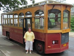 _With Debbie’s help we walked through the 2 hours quickly and then made our way back to the dock for our cruise. Lockport Locks has two tour boats and for $26 we enjoyed a great hour and a half ride through the double locks and canal. A lot of the Erie Canal was built by blasting out the 20 foot high stone walls with gun powder left over from the War of 1812. The original canal was enlarged twice up to today. The use of the canal has changed considerably with the commerical barge changing places with the pleasure boating crowd. 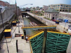 _The total rise over the 363 miles of canal is 570 feet once it reaches the Great Lakes from the Hudson River and the Atlantic Ocean. Today while we were in locks 34 and 35 we had a rise and fall of 49 feet and all that was done by closing both doors on the locks and allowing the water to flood in and out without any help from pumps. Nothing has changed in that regard since the opening of the canal. 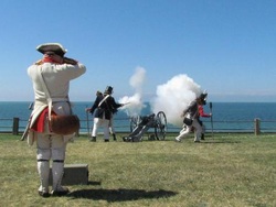 Well this afternoon we received our little shipment from DHL. Somehow the address sending this little package was wrong, but with a few phone calls and a little bit of luck we got a “special” delivery. By special I mean that the manager of the DHL office in Buffalo drove out here (about 15+ miles) in his personal pickup to make sure that we had our part and we could get back on the road. Thank you DHL!!! Well I had better get myself caught up before we leave again and I find myself further behind. A couple of days ago Louise and I drove north alongside the Niagara River and following the Great Lakes Seaway Trail. As a scenic driving route and one of the first roads in America to be designated a national Scenic Byway, it wasn’t surprising to us that the scenic sites along the Great Lakes Seaway Trail can be and are breathtaking. A lot of this beauty is a result from the end of the Ice Age, when the glaciers that covered this area retreated, leaving behind some incredible water resources in the lakes and large estuaries all around us. 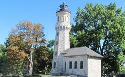 When looking down on a topographical map it is amazing just how the ice cut and scraped this area and to see what it left with the gorge and beauty of Niagara Falls. Just 15 miles north of where we are now is the location where most of the War of 1812 took place. 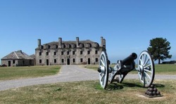 All along the Great Lakes Seaway Trail the British interfered with the American shipping and with the seizure of American sailors a war was started. 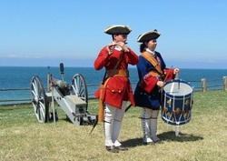 If everyone had known that all would return to the “status quo” after the war everything bad could have been saved. There was a moment in history on the 19th of December ,1813 when the British troops fought their way into Fort Niagara to capture the post from the United States. 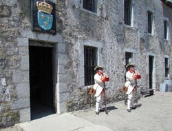 The most important trophy taken by the British was Fort Niagara’s garrison flag, an immense version (24’X28’) of the “Stars & Stripes”. Six months after the battle the flag sat at the feet of the future King George IV. The huge flag remained in the hands loving hands of the descendants of Sir Gordon of Scotland until 1994 and then it was returned to the U.S. and the Old Fort Niagara Association were it is displayed today. There is more than a 300 year history of Old Fort Niagara and the local populous are very proud of it. 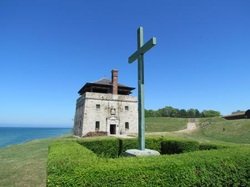 I thought I would post for the family showing the states we've covered so far: |
*Locations*
All
*Archives*
November 2016
|
