Goodman's Journey
  • Home
  • Blogroll

Me A Rockhound ???

12/28/2008

0 Comments

 
Picture
_28 December ‘08 Sunday

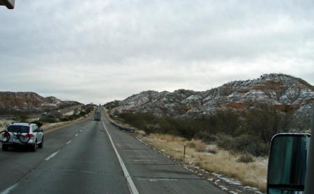
Friday was our last day in Casa Grande.  We pulled out of the gate about noon and headed to Safeway to top off the fuel tank.  We’ve been saving the “gas discount” points so when we pulled in we were able to pick up 35 gallons of diesel for $1.67 and then top off the remainder 10 gallons at $1.96.  Man, just a few months ago we would have been paying close to $4 to $4.50 for the same fuel.  About an hour out of Casa Grande and we started to find our windows getting covered with some large rain drops.  Just as we were passing through Tucson we noticed that the large rain drops were now turning to snowflakes. 


Picture
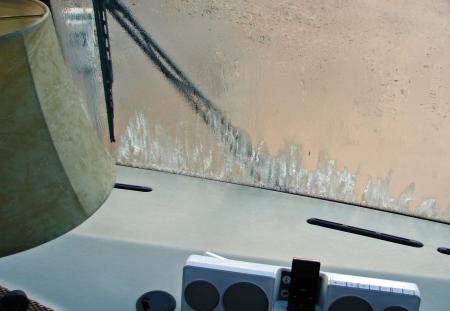
_Fortunately we had planned to spend the night at Western Horizons St. David.  As we pulled up to register, the ground was starting to be completely covered with a light snow cover and the temperature was dropping fast.  Time to settle in for the night…plug in the electricity, drop the air, level and snuggle… As we pulled the curtains back from the windshield in the morning we were surprised to find ICE ON THE INSIDE OF the windshield…

Picture
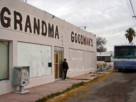
_what the heck is this, we’re supposed to be in SOUTHERN ARIZONA… Being Saturday, the clubhouse was selling freshly made cinnamon rolls so I grabbed a couple of “travel treats”.  We were on the road again by 9:30 and fortunately we’ve left the rain and snow behind.  As we passed through Benson this morning, we had to stop for a picture…Grandma Goodmans… 

Picture
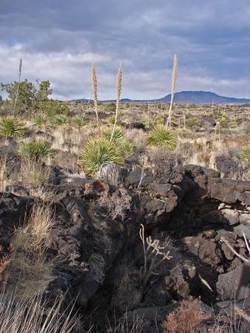
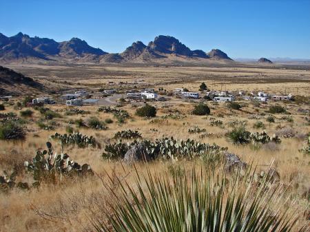
_Our route will take us to Deming, New Mexico via I-10 and then we will jump off the highway and find our way up to Rock Hound State Park.  I was a little worried that the campground would be full as we were coming in a little late and on a Saturday…  Well as luck would have it, they had 2 spots left with electrical hook up and we were going to get one.  We felt that electricity was important for our stay with the temperatures dropping so low.  Fact is, last night it got down to 17 degree and we just couldn’t get the feeling of warmth in the coach without having the furnace operating full on.  Rockbound SP sits on the slope of Little Florida Mountains and overlooks the surrounding areas of Deming in the valley below.  There are 29 campsites here and most are taken up by “rock enthusiasts”.  They are looking for a large variety of rocks and minerals, ranging from silica, quartz crystals, agate, common opal, to thundereggs and geodes.  The “rockers” can gather 15 pounds of rock per person and if you can’t see them out there on the hills, you can hear them digging and hammering.  Well Louise just had to give it a try.

Picture
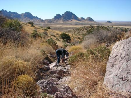
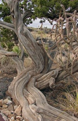
_With a stick (that's all she could find in a quick moment of need) she dug her way through the rock and dirt.  She did find some "pretty rocks", but decided that we don’t want to weigh down the coach with rocks so we’re making the most of the area by hiking and a little bit of digging.  The trails are plentiful and we’ve had a chance to cover a few of miles already this morning.   Our first hike took us high up the hillside and kind of followed the shape of the campground below. 

Picture
Picture
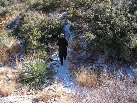
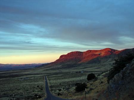
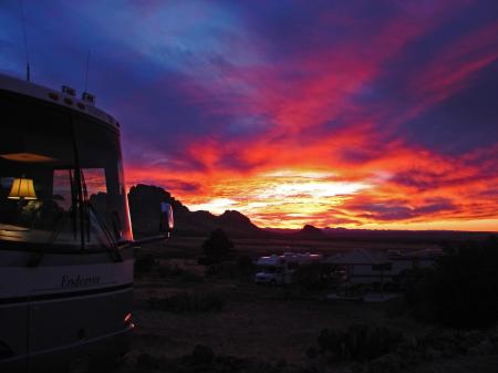
_The flora was tall grasses, cacti, and assorted desert brush.  Those that were “rocking” were found in the crevice areas of the mountains, and as we hiked by we could hear them at their work.  About three miles across the valley, is another state park.  It’s called Spring Canyon State Park.  Last night we had a beautiful sunset that set behind Spring Canyon and this morning, we went to explore those hills.

Picture
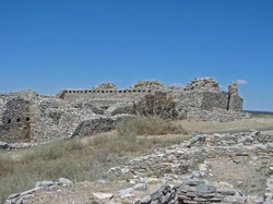
_The rock formations at Spring Canyon are wonderful.  They are so wonderful that the Ibex Goat that was introduced to the area 40 years ago from Iran, have found this to be a perfect place to live and reproduce. 

0 Comments

The Turquoise Trail...

4/9/2008

0 Comments

 
Picture
9 April ‘08

Wednesday

About a month ago we had a little “accident”…Louise accidentally spilled some water onto and into our GPS.  Well, we found out that GPS systems and water just don’t mix and if we wanted to send it to the factory they would try to fix it for us at a base price of $199 plus $17 shipping and handling.  Monday we decided to drive down into Albuquerque to do a little shopping at Costco (who in the world goes to Costco and does a LITTLE SHOPPING???)  Anyway, we found a new GPS system and yesterday we drove the Turquoise Trail (62 miles) to try it out.  There was a little set-up work that was required to get the GPS system to follow the directions the way I would prefer, so I set it to avoid “Toll Roads” and besides that, they don’t have any around here.  As our car pulled away from the coach, directions started to flow freely from our new system.  I dutifully followed every turn and only questioned it once…when this road that we were traveling on (which definitely wasn’t even close to a toll road) all of a sudden narrowed down to a single lane and then became a dirt track… Well we could have turned around and driven back the 10 or 12 miles that we had driven, but we could also keep following our “GPS”.  Thankfully Louise had fixed a lunch to take with us, so I knew that we wouldn’t starve no matter how far off the track our new system took us.  Fortunately, this little dirt track did take us on a little short-cut and we finally found our way to The Turquoise Trail.  Our first stop on Rte 14 was at Madrid. 


Picture
Madrid was featured in the recent movie “Wild Hogs” and the famous, Maggie’s Diner.

Picture
Madrid is really nothing more than a curve in the road that once was a coal mining town that didn’t do too well.  It really hasn’t changed visually a great deal except in color and inhabitants.  The “artists” have moved in and now, it’s “The HAPPENING PLACE”.   It’s so happening, Louise actually found a couple of pieces to purchase.  Seeing as we live in the motor home, we are limited to wall and counter space, so having her find something to purchase is quite rare.  Now if Lou can find something to buy, so can.  On main street we found this great little coffee house…yep, I just had to stop by and check out their quality.

Picture
Now with the motto of “Bad Coffee Sucks”, who could pass the challenge??? 

Picture
We did walk from one end of town to the other (this took about an hour, including walking into a number of the galleries)  and then continued our drive up the Turquoise Trail.  10 minutes up the road we found a turn-off to enjoy the “box lunch” that Lou had put together for us.  25 miles further up, we arrived in Santa Fe.  I found it hard to believe, but Santa Fe, New Mexico is the 2nd oldest city in America.  It’s almost 400 years old, but shows it’s age well with the modern Spanish Pueblo look.  In our walk around the plaza, it was almost unbelievable that we were walking the same area as those 4 centuries ago.  “Painters and photographers

Picture
have been drawn to Santa Fe because of its starkly beautiful scenery and undiffused Southwestern sunlight”.  Santa Fe is located at the base of mountains that reach well over 12,000 feet, but as we found out, Santa Fe is its self at 6,989 feet.  In 1610, the Cathedral of St. Francis of Assisi was located and founded where it is today. 

Picture
It has grown but the beauty was and is today, magnificent. 

Picture
We have had the chance to visit quite a few cathedrals in our travels, and this one doesn’t take a back seat to many. 

0 Comments

"Trinity"...

4/5/2008

0 Comments

 
Picture
5 April ‘08

Saturday

“The effects could well be called unprecedented, magnificent, beautiful, stupendous, and terrifying.  No man-make phenomenon of such tremendous power had ever occurred before…”Trinity””.  Twice a year the government opens the Trinity Test Site at the White Sands Testing Grounds, and we were there on one of those days.  The Trinity Test Site is the location of the “Manhattan Project”, where in June 1942 the final design and testing of the world’s first atomic bomb took place.

Picture
No matter what our personal feelings about the bomb and the testing, it was a part of our history.  The fact that we were in the area on one of the days that they open the site to the public was exciting.  To pass through the gates and see where the “event” took place, to stand on “ground zero”,

Picture
and to know that the world was changed forever when the testing was successful, was very sobering.  Yep, while traveling we do see the “unprecedented, the magnificent, the beautiful, and the stupendous, but thank God we don’t often see the terrifying”.

Picture
0 Comments

From Lava to Pueblo

4/4/2008

0 Comments

 
Picture
4 April ‘08

Friday

Last night we pulled into The Valley of Fire National Park and found ourselves a great camping site.  There are only 6 sites that have water and electric hook-ups and we found one available.  Valley of Fire campground is the location that over-looks the lava flows that have covered more than 150 miles of New Mexico.  We sit about 80 feet above the flow and have a view over all the flow and a part of the White Sands Bombing Site…fact is, we just had a couple jets do a low run over our heads and disappear into the mountains in front of us.  The deafening sound of the jet and then the blast in the distance of their bombs, made it kind of exciting.  Below us, there is a wonderful pathway that winds around for over ¾ mile over the top of the lava.


Picture
You can stay on the path or wonder down into the flow to get the close up view.

Picture
Last year at Lava Beds National Monument in northern California, we learned that the lava flows can be very sharp, so we stayed on the wonderful path that was provided for us.  At the end of the boardwalk we were stricken with the artistic beauty of a "One Seed Juniper" tree...it was striking in contrast with the black lava.

Picture
There are a lot of stones in the Salinas Valley as we found when we visited the Pueblos.

Picture
The Salinas Valley Pueblos were built over 300 years ago by the Anasazi and Mogollon societies.  Now I don’t have any idea as to who they were but they definitely were builders.  All around the pueblos, the Indians developed a large farming and living community.  The pueblos at Salinas Valley were individually small but as for the complete community it was considered large.

Picture
 What we visited today was the contiguous stone and adobe homes of the Anasazi.  It is estimated that at one time, more than 10,000 people once lived and worked here.  They not only raised, and gathered their maize (corn), pinon nuts, beans, and squash, they were hunters.  Soon after Spain conquered and colonized Mexico, they (the Spanish) traveled north and soon found their way to Salinas Valley.  We read a little of the differences of the Pueblo and Spanish priests and the direction of how things went from there…not always friendly!!!  During the times that were a little rough, there were “hidden” rooms that some of the Pueblo peoples would go to for their safety.  The dwellings seemed to be either single or double floored, but where the hidden rooms came in, a larger hole was dug and then rocked over with a hidden entry someplace un-noticed.


Picture
The rock walls for all the pueblos were at least 2 feet thick, and this gave the people the insulation that was needed for the winters and hot summers, and of course, for their security. 

0 Comments

From The Prehistoric Jornada Mogollon...

4/3/2008

0 Comments

 
Picture
3 April ‘08

Thursday

Just 15 miles further north of the sand dunes was our overnight stay…this was our 2nd Wal-Mart parking lot stay since we started all of this.  We stayed in Alamogordo, New Mexico which is a small town that is mostly supported by the military installations around the area.  Another 30 miles north from Alamogordo is a very interesting place to spend some time.  It’s called the 3 Rivers Petro glyph Site.   They have recorded well over 21,000 petroglyphs that were left for us to enjoy by the prehistoric Native Americans from 1,000 years ago. 

Picture
The pictures were made with stone tools by removing the dark patina on the exterior of the rock.  Some of the pertroglyphs were made by simply scratching the patina to the lighter layer below and others were created by striking (“pecking”) through the patina.  The site is about 5 miles off of the highway and sits on about 60 acres of an area of small hills that over look the vast   flatlands below. 

Picture
They feel that this was most likely a trading area for all the different tribes that frequented the area from miles away.  As we go into all of these different sites, we are constantly reminded that this is “snake country” and they are now out.  I hope that we don’t get complacent, but so far we haven’t seen or heard one of the rattlers, but we’ll keep our eyes and ears open…

0 Comments

From Transmission to White Sands...

4/2/2008

0 Comments

 
Picture
2 April ‘08

Wednesday

We finally got our car back… For the last couple of months we’ve had this howl coming from the transmission area and I just felt that Sierra Vista might be the place for us to have it looked at.  The work was all done under warrantee and they thought they might be able to get it done for us in 3 or 4 days.  Well it took 7, but who’s counting???

Picture
After picking up the car at the dealer, I found that it had the sound of a vibration so back I went.  To shorten this up a little, a couple of months ago we went into the red clay area of Yuma and put so much of that “goo” under and around the car, that I wasn’t able to get it off even after using the under car power wash 3 times.  Now the dealer decided that it just had to be some of that mud that was stuck on the rear wheels and putting them out of balance.  OK, let’s not argue the point, let’s just give it a try…so we are…  Well, we pulled out this morning from Sierra Vista and are hoping for the best.  Our route took us east on Arizona Hwy 10 all the way to the White Sands Proving Grounds in New Mexico and the glistening white sands of the Tularosa Basin.

Picture
The Tularosa Basin is in the northern end of the Chihuahua Desert…is that too much information?  Anyway our first stop was at the White Sands Visitor Center.  There we learned about proving grounds were they test fire all the missiles, sometimes land the space shuttle, and the 8 mile circular drive through the “White Sands National Monument”.  About two miles off of the highway, we found waves of glistening white gypsum dunes.

Picture
The brilliant white gypsum dunes are the largest in the world and we’re running around in our bare feet to really “get the feel”.  The semi constant blowing wind (it was blowing pretty good today) is constantly changing the look of the dunes by moving them about 30 feet a year. 

0 Comments

    *Locations*

    All
    Amsterdam
    Austria
    Belgium
    Bosnya
    Canada
    Croatia
    Czech Republic
    Egypt
    England
    Estonia
    France
    Germany
    Germany Part 2
    Greece
    Hungary
    Ireland
    Italy
    Latvia
    Lithuania
    Luxembourg
    Madrid
    Mexico
    Mexico Bcs
    MX - Cabo San Lucas
    Netherlands
    Poland
    Portugal
    Scotland
    Serbia
    Slovakia
    Slovenia
    Spain
    Switzerland
    Turkey
    USA - Alabama
    USA - Alaska
    USA - Arizona
    USA - California
    USA - Colorado
    USA - Florida
    USA - Georgia
    USA - Idaho
    USA - Illinois
    USA - Indiana
    USA - Kentucky
    USA - Louisiana
    USA - Maine
    USA - Maryland
    USA - Massachusetts
    USA - Michigan
    USA - Minnesota
    USA - Mississippi
    USA - Montana
    USA - Nevada
    USA - New Jersey
    USA - New Mexico
    USA - New York
    USA - North Dakota
    USA - Ohio
    USA - Oregon
    USA - Pennsylvania
    USA - Seattle
    USA - South Dakota
    USA - Tennessee
    USA - Texas
    USA - Utah
    USA - Vermont
    USA - Washington
    USA - Wisconsin
    USA - Wyoming
    Utrecht Nl
    Wales


    *Archives*

    November 2016
    September 2016
    August 2016
    January 2016
    December 2015
    November 2015
    October 2015
    September 2015
    August 2015
    July 2015
    June 2015
    May 2015
    March 2015
    February 2015
    January 2015
    December 2014
    July 2012
    January 2012
    December 2011
    November 2011
    October 2011
    September 2011
    August 2011
    July 2011
    June 2011
    May 2011
    April 2011
    March 2011
    February 2011
    January 2011
    December 2010
    November 2010
    October 2010
    September 2010
    August 2010
    July 2010
    June 2010
    May 2010
    April 2010
    March 2010
    February 2010
    January 2010
    December 2009
    November 2009
    October 2009
    September 2009
    August 2009
    June 2009
    May 2009
    April 2009
    March 2009
    February 2009
    January 2009
    December 2008
    November 2008
    October 2008
    September 2008
    August 2008
    July 2008
    June 2008
    May 2008
    April 2008
    March 2008
    February 2008
    January 2008
    December 2007
    November 2007
    October 2007
    September 2007
    August 2007
    July 2007
    June 2007
    May 2007
    April 2007
    March 2007
    February 2007
    January 2007
    December 2006
    November 2006
    October 2006
    September 2006
    August 2006
    July 2006
    June 2006
    May 2006
    April 2006
    March 2006
    February 2006
    January 2006
    December 2005
    November 2005
    October 2005
    September 2005
    August 2005
    July 2005
    June 2005
    May 2005
    April 2005
    March 2005
    February 2005
    January 2005
    December 2004
    November 2004
    October 2004
    September 2004
    August 2004
    July 2004
    June 2004
    May 2004
    April 2004
    March 2004
    February 2004
    January 2004
    December 2003

Goodman's Journey © 2021 | All Rights Reserved.
​Website Creation by Amy Riordan, LLC