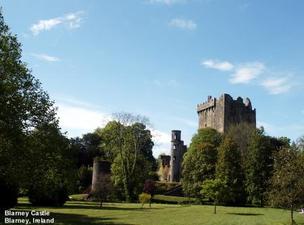
Yesterday we got underway by heading down the hill to the Blarney Castle. Parking was no problem because of the time of day, but let me tell you, some of those that are on bus tours get an early start. There was at least 4 buses there before us. Blarney Castle is set into a wonderful location, as most other castles are, but this one was especially so. A small river winding around through beautifully planted and undulating grounds, and the castle was good looking structure as well. As we entered the castle, all signs indicated that the “kissing stone” was at the top. The stairs were those that we’ve found in all the castles, very small steps that wind up and up. It is amazing to us as to how those that lived in a castle lived with these small stairs. I guess the reason for the size, is during an invasion and the invader found their way in, the small stairway was still defendable for a little while longer. Anyway, we made it to the top. The view was wonderful and the line fortunately, was small so we were able to get our “kiss of the Blarney Stone” without any delay. It is quite a routine they have there. Once you’ve found your way up, there is a man there to hold onto you as you lay down on your back, bend back your head, and kiss the bottom of this stone. The location of this stone is were they used to dump hot tar, water, and anything they could get their hands on at the time of an invasion. It was to land on those below to keep them thinking about their invasion…do I go on, or do I run ?
For us, it was to “run”, or maybe walk, but we found our way down, took a lot of pictures and were on our way again. This time we were headed to the Dingle Peninsula and the town of Dingle. It was a nice drive, making our way by Mallow, then onto Killarney, and then up to Tralee. From Tralee we enter the peninsula and the drive to Dingle is about 40 miles. We had our choice of 2 routes, so we took the one that is “most traveled”…what a mistake that was…this road was either under construction or should have been…it was BAD !!! Once we got there, we stopped in town for a lunch and a short walk through town. We will be back and take in the “night life” tonight, but first get to the campgrounds and get set up. The camp is out of town about 2 miles and is located at an early 18th century “Hunting Lodge”. Fact is, we asked if there were any ghosts that still haunted the place…the young girl that ran the place kind of turned a pale color and said “yes”, and I have seen them… Well, about 9pm we called for a taxi to come get us, and we were out for the night of bar hopping, listening to Irish music, drinking Irish beers, and singing what little Irish songs we knew. About midnight, we found a very small restaurant, had a great hamburger, and called for the cab. This morning we weren’t up quite as early, but when we did navigate our way out of bed, it didn’t take long and we were on our way again. This morning we wanted to take a drive around the “Dingle Loop”…that is to take a 30 mile trip around the end of the peninsula, which ends back at Dingle. The day was bright and sunny again (we’ve been really lucky, as it has been sunny almost every day we’ve been in Ireland). We were right on top of the coastline, and the views of the water, cliffs, and the fields were spectacular. We also came across a couple of the ancient sites, were they lived in stone “Beehive Huts”. These Beehive huts were also in “Ringforts”. The majority of these were enclosed farmsteads of the free farmers of the Early Christian Period. They think they would have been inhabited about 1200 AD. We also went across, or through, an up-side-down bridge…this road, which is so narrow, that every once in a while you have to pull over and stop for the on-coming car to pass, had this hair-pin corner that had a full stream of water coming across the roadway (on purpose), and then cascading down the rock walls to the Atlantic Ocean below. Well, a lot more to tell you, but space of limited, so off for now.
Tomorrow…Doolin
